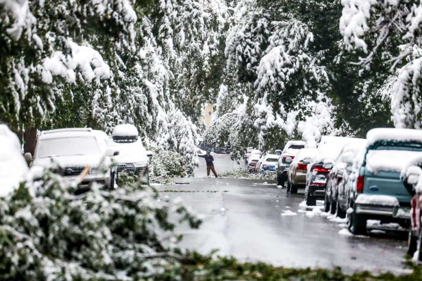
A major winter storm is on track to affect regions of the Northeast and Mid-Atlantic this Wednesday and Thursday, reported by the National Weather Service (NWS).
Ponderous Snow to Precede Potential Blockbuster Storm
Heavy snow is expected west and north of the I-95 corridor in Philadelphia, Washington DC, New York City, and Boston metropolitan regions.
Meanwhile, in the south, "freezing rain and ice accumulations" are possible in northwest North Carolina and throughout much of central and southwest Virginia.
According to the NWS, "Confidence is high that this winter storm will result in significant impacts including travel disruptions and power outages across much of the Mid-Atlantic and southern New England," reported Independent.
Named Winter Storm Gail by The Weather Channel, the weather is likely to bring strong winds, major snow, and some coastal flooding to regions of the mid-Atlantic and Northeast commencing on Wednesday.
The upper-level energy that would in turn spawn this East Coast storm is currently located in the Rockies, where it will be prevalent in generally light snowfall through the Rockies and then regions of the Plains through Tuesday.
The significant winter storm on Wednesday into Thursday has the likelihood to result in prevalent power outages and halt travel along the Interstate 95 corridor, also according to the NWS.
The season's first major snowstorm could develop into a "nor'easter" along the Eastern Seaboard arrives as economic losses are rising from the restaurants closing and other service-related businesses as the United States grapples with spiking COVID-19 cases, fatalities, and hospitalizations.
The NWS announced, "Heavy snow is expected west and north of the 1-95 corridor, and near the Washington D.C., Philadelphia, New York City, and Boston metropolitan areas. Meanwhile, there is a growing concern for freezing rain and ice accumulations across parts of northwest North Carolina and southwest Virginia," reported Zero Hedge.
As the energy reaches the eastern states on Wednesday, it would produce and amplify a region of low pressure near or off the East Coast. Strong high pressure in eastern Canada is also simultaneously expected to supply new, cold air into the Northeast.
The NWS wrote on Twitter, "We will be able to share more specific snow total information tomorrow as we monitor the expected midweek storm system. For now, here is the probability of 6" or more of snow for the system, per the NWS's National Blend of Models." The highest probability of heavy snow remains to the east.
The potential winter storm last Friday could have adverse effects on restaurants that are grappling to survive with outdoor dining.
Before impacting driving conditions along the Intestate 95 corridor from Philadelphia, Washington DC, Boston, and New York, initially, the cold outbreak would prevail into the Northeast United States and favorable conditions for an ice storm along the Appalachians.
AccuWeather's group of meteorologists is becoming more adamant that the significant storm will unfold from Tuesday to Thursday and unload over 2 feet of snow in spots, with an AccuWeather Local StormMaxTM of a maximum of 30 inches.
© 2026 HNGN, All rights reserved. Do not reproduce without permission.


