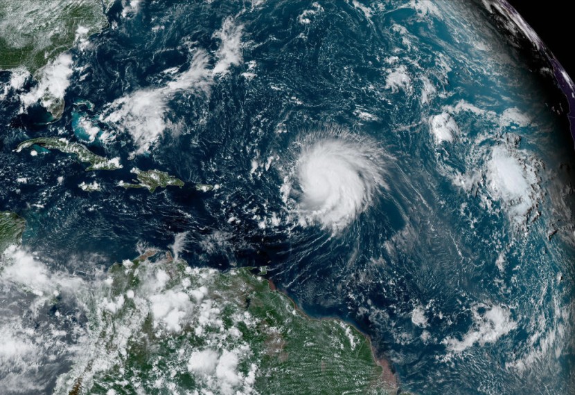
Hurricane Lee is threatening much of coastal New England with heavy rains and powerful winds as the storm continues on its path, inching closer and closer.
Officials issued the tropical storm watch on Wednesday for much of coastal New England, Watch Hill to Stonington, including Block Island, Martha's Vineyard, and Nantucket. The National Hurricane Center and the National Weather Service (NWS) said they expect "an increasing risk of wind, coastal flooding, and rain impacts from Lee in portions of New England."
Hurricane Lee Update
On the other hand, Southern New England is facing another round of flooding brought on by a powerful storm. The NWS also issued a tornado warning late Wednesday, saying it would continue for Greenville, Chepachet, and Harmony, all of which are in Rhode Island.
The weather service's website also issued a tornado warning for East Central Windham County in northern Connecticut and Western Providence County in Rhode Island.
According to CNN, the National Hurricane Center said that a hurricane watch has been issued for eastern Main as hurricane conditions, heavy rainfall, and coastal flooding are possible in portions of the region on Saturday.
In a statement on Wednesday, Maine Gov. Janet Mills urged residents of the state to "exercise caution and to take common-sense steps to ensure that they have all they need to stay safe as the storm draws closer."
Additionally, the hurricane center warned that there is the possibility for "life-threatening storm surge flooding" in some parts of southeastern Massachusetts. This includes areas such as Cape Cod and Nantucket and would be sometime late Friday and Saturday.
Officials expect that Hurricane Lee's winds could come as early as Friday evening for several areas in New England. The powerful storm, which remained a Category 2 hurricane on Wednesday evening, was located around 370 miles south-southwest of Bermuda.
Powerful Storm
Ahead of Lee's brush with Bermuda on Thursday, a tropical storm warning remains in effect for the island. According to CNN, it added that the center of the powerful storm is forecasted to pass west of Bermuda on Thursday and will then approach the coast of New England and Atlantic Canada on Friday and Saturday.
While officials expect Hurricane Lee to weaken with time, its impacts beyond its center will be significant due to its massive size. It has grown severely since the weekend. Officials warned that hurricane-force winds can extend outward up to 115 miles from the center, while tropical-storm-force winds can extend outward up to 265 miles from the center.
While powerful, Hurricane Lee is nowhere near how it was when it was still a Category 5 hurricane over the open Atlantic. But meteorologists warn that it could still significantly impact the areas it will pass through.
There have only been six hurricanes in history that have experienced similar levels of rapid strengthening as Hurricane Lee has. Accuweather said these include 2005's Hurricane Wilma, 2017's Hurricane Maria, and 2020's Hurricane Eta.


