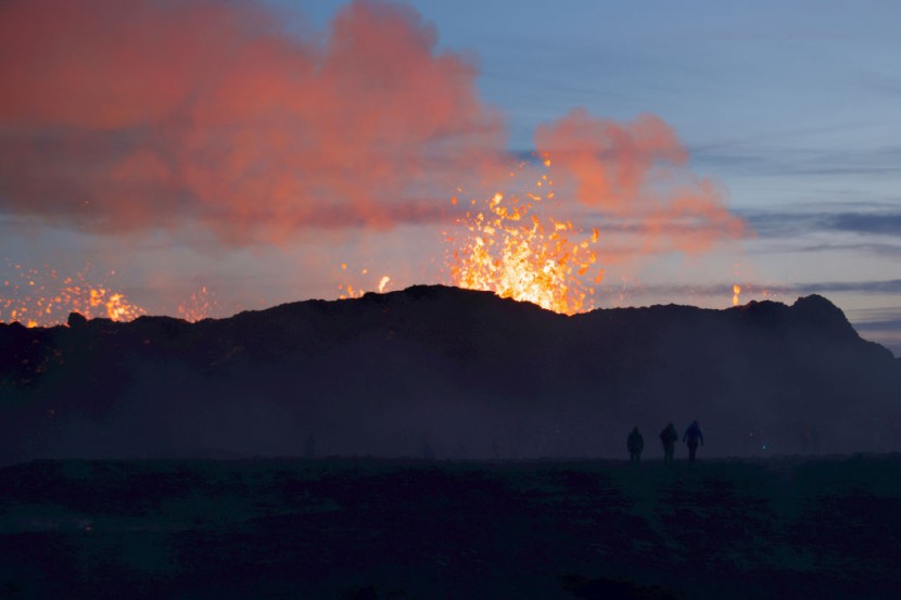
Iceland officials have ordered the evacuation of residents of Grindavik after a swarm of earthquakes struck, including two with magnitudes of 5.0, and have caused concern for a potential volcanic eruption.
The tremors rocked the country's Reykjanes Peninsula on Friday and suggest that a possible eruption could come in the following hours or days. The situation has prompted the Icelandic Meteorological Office to declare a Civil Protection Emergency Level.
Iceland's Potential Volcanic Eruption

The volcano in question is the Fagradalsfjall volcano which is located in Iceland's southern peninsula region roughly 25 miles southwest of the capital Reykjavik. There were a number of earthquakes that shook the city and forced officials to close the famed Blue Lagoon geothermal spa in Grindavik.
Initially, it was unclear if the Fagradalsfjall volcano was responsible for the increased seismic activity or if an eruption was brewing elsewhere within the Reykjanes volcanic system. Officials ordered the evacuation of all the people in Grindavik shortly before midnight local time, as per the Washington Post.
About half an hour before midnight, the Meteorological Office warned that volcanic fissures could open near or within the town itself. In a statement, the office added that based on how the seismic activity had evolved in the last few hours on that day, along with results from GPS measurements, there was a chance that a magma intrusion had extended beneath the town.
Experts also believe that a magmatic dike could have formed directly below Grindavik. These are sheets of magma that either flow through existing fractures in rock or generate a new crack themselves. The largest volcanoes are known to contain hundreds of dikes.
Officials have declared a Code Orange, or a level 3 out of 4 on the universal ground-based volcano alerting scale. The decision raises concerns at Keflavik International Airport, which is located just northwest of the seismically active region.
The situation comes as Iceland is one of most active volcanic areas on the planet and rather than having a central volcano, the Reykjanes Peninsula is dominated by a rift valley. It is filled with a series of lava fields and cones, according to CNN.
Read Also : South Korea Industrial Robot Crushes Man to Death After Failure To Differentiate Worker From Boxes
Thousands of Earthquakes
The Icelandic Met Office reported that there were around 1,400 earthquakes that were measured in the 24 hours leading up to around midday on Thursday. There were another 800 in the first 14 hours of Friday.
In a Nov. 8 statement, the office noted that there were roughly 1,2-00 earthquakes recorded in the 24 hours prior to the latest numbers. These occurred in the same area and at the same depth, roughly five kilometers below ground level.
The tremors that were recently recorded came as the region reports, on average, 26,000 earthquakes every year. Roughly 20,000 have already been recorded by the IMO since seismic activity started last month.
The reason for the high frequency of tremors is because of Iceland's positioning on a tectonic plate boundary. A Reykjavik-based natural history museum, Perlan, said that in Iceland, earthquakes are a fact of life, said Forbes.


