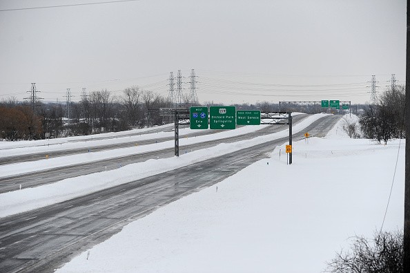
The powerful winter storm rattled the northeastern US with blizzard warnings and heavy rain that would continue to create hazardous conditions coast-to-coast through the middle of the week in multiple states, including New York.
According to the Storm Prediction Center, nearly 70 million people in the Southeast and Gulf Coast region are at risk of severe weather.
Winter Storm Rattles Northeastern US

On Sunday morning, winter storm warnings were in effect in parts of the East Coast and Nevada, with blizzard warnings in place for almost twice as many people. Another two to four inches of snow were expected to fall throughout the day in parts of upstate New York, which had already seen at least several inches and was recognized as the season's biggest snowstorm.
According to the National Weather Service, the Hudson Valley of New York recorded 11 and 13 inches of rain on Saturday. Five to six inches of snow fell on parts of New Jersey and Connecticut, and the Mount Holly weather service bureau warned areas of northern New Jersey and Pennsylvania to brace for up to an inch or two of snowfall per hour on Saturday night.
CBS Boston said on Sunday that up to seven inches of snow had fallen in various Massachusetts counties.
The winter storm was expected to hit the Northeast and Appalachian regions on Sunday with strong winds and four to eight inches of new snow before moving over the coast and into the Atlantic later at night. The meteorologists reported that conditions should improve on Monday.
Furthermore, the weather service reported that a second winter storm system was traveling through the Rockies on Sunday. The storm was expected to bring a wave of moderate to heavy snow to a vast section of the area before moving into the southern Great Plains on Monday.
Most of the snowfall connected with the second winter storm was predicted to fall across the Midwest, with local totals estimated to approach 12 inches.
The storm intensified rapidly on Sunday as it started to move northeast from California and was expected to reach the Midwest and portions of the Northeast by mid-week. On Monday night and Tuesday, heavy snow from the Great Plains was expected to travel into the Midwest, and forecasters warned that the combination of strong winds may result in blizzard conditions in both locations.
The third storm system was predicted to hit the Pacific Northwest on Sunday night with severe winds and a lot of rain to coastal locations.
Read Also : 4-Year-Old Girl Overdoses on 'Rainbow Fentanyl' in Eastern Washington Motel, Parents Charged
Winter Storm Moves Southeast
The weather service warned that formidable winds of 50 miles per hour or higher could harm the Appalachian Mountains and even the East Coast. They also noted that thunderstorms could affect the Southeast and parts of the Gulf Coast early in the week.
"Heavy rain Monday into Wednesday will likely lead to river and possibly flash flooding from the central Gulf Coast through the Northeast," the weather service announced in an advisory. "Powerful onshore winds will also likely lead to coastal flooding along much of the East Coast."
Meteorologists warned that the storm could cause river and flash flooding, especially in the Carolinas and the mid-Atlantic region. As of Sunday, there was a slight risk that severe thunderstorms could develop in the southern regions of Texas, Louisiana, Mississippi, Alabama, and the western panhandle of Florida in the next few days.
The residents in those areas were advised to prepare for power outages and possible tornadoes.
Related Article : Nordic Snowstorm Brings Extreme Cold, Traps Hundreds of Vehicles


