
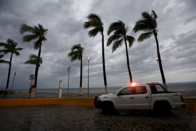
The National Oceanic and Atmospheric Administration on Thursday released its outlook for the 2024 Atlantic hurricane season, predicting a hyperactive year among the top dozen since 1950, and Florida is set to endure this intense season with two major hurricanes likely to hit the state.
This year's hurricane season, which runs from June 1 to November 30, is likely to spawn between 17 and 25 named storms, which feature winds of 39 mph or higher, according to National Weather Service forecasters at the Climate Prediction Center. Of those, between eight and 13 are forecast to become hurricanes, with winds of 74 mph or higher, including between four and seven major hurricanes, defined as category 3, 4, or 5, with winds of 11 mph or higher.
There is a 90-95% chance of a hyperactive hurricane season for Florida with at least two-thirds more total tropical activity than normal and a most likely outcome of a little over twice average activity, a 10% increase from WeatherTiger's March forecast, according to the Tallahassee Democrat.
The 2024 season has a 50% chance of seeing 22 to 26 tropical storms, 10 to 13 hurricanes, and 5 to 8 major hurricanes.
Overall, forecasters say there is an 85% chance of an above-normal hurricane season, a 10% chance of a near-normal season, and a 5% chance of a below-normal season.
The above-normal storm activity is expected to due the combination of warm ocean temperatures in the Atlantic, La Niña conditions in the Pacific Ocean, and reduced Atlantic trade winds and wind shear.
"With another active hurricane season approaching, NOAA's commitment to keeping every American informed with life-saving information is unwavering," NOAA Administrator Rick Spinrad said in a statement. "AI-enabled language translations and a new depiction of inland wind threats in the forecast cone are just two examples of the proactive steps our agency is taking to meet our mission of saving lives and protecting property."
The National Hurricane Center is expanding its Spanish-language text products to include all Public Advisories, the Tropical Cyclone Discussion, the Tropical Cyclone Update and Key Messages in the Atlantic basin.
Beginning on Aug. 15, the NHC will begin using an experimental version of the forecast cone that includes inland watches and warnings in effect for the continental U.S. The NHC will also begin issuing intermediate advisories to update tropical cyclone watches and warnings without waiting for the next full advisory, which are issued every six hours.
"Severe weather and emergencies can happen at any moment, which is why individuals and communities need to be prepared today," said FEMA Deputy Administrator Erik A. Hooks. "Already, we are seeing storms move across the country that can bring additional hazards like tornadoes, flooding and hail. Taking a proactive approach to our increasingly challenging climate landscape today can make a difference in how people can recover tomorrow."
--with reporting by TMX


