
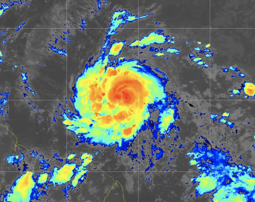
Tropical storm Beryl quickly morphed into an "extremely dangerous" Category 4 hurricane Sunday and was barreling toward the Windward Islands of the Caribbean packing maximum sustained winds of 130 miles an hour.
The National Hurricane Center warned that the first hurricane of the season — the earliest Atlantic Category 4 hurricane on record — is expected to "destructive winds and a life-threatening storm surge" first to Barbados and the Windward Islands of St. Lucia, Grenada, St. Vincent and the Grenadines by Monday.
Beryl will pose a "very dangerous situation" for those islands, National Hurricane Center Director Michael Brennan warned in a video update.
Beryl's center, about 310 miles southest of Barbados Sunday afternoon, is predicted to pass about 70 miles south of the island on Monday morning, Sabu Best, director of Barbados' meteorological service, told the Associated Press.
The surge could increase water levels by as much as 7 feet above normal, and drop up to 6 inches of rain.
Beryl was tracking to move northwest through the Caribbean over the week, eventually tearing through Jamaica and approaching southern Mexico.
The islands directly in Beryl's path were beginning to shut down Sunday and prepare for the worse. Windows were boarded up and residents sought safe shelter and stocked up on food and water as long lines formed at gas stations and grocery stores in Barbados and the other islands.
Thousands of people were in Barbados for Saturday's T20 World Cup final, cricket's biggest event. Prime Minister Mia Mottley noted that not all fans were able to leave Sunday despite scrambling to change flights, AP reported.
Researchers are predicting an extraordinary hurricane season this year.
© 2026 HNGN, All rights reserved. Do not reproduce without permission.


